Reporting by Victoria E. Freile, New York Connect Team / Rochester Democrat and Chronicle
New York is launching FloodSafe NY, a new statewide monitoring network designed to help communities better understand and predict flooding and respond to extreme weather.
Gov. Kathy Hochul on Monday announced the launch of FloodSafe NY, a partnership between the New York State Department of Environmental Conservation and the U.S. Geological Survey to develop what officials described as the nation’s first statewide Hydrologic Monitoring Network.
According to state officials, the improved technology will help communities anticipate flood risks earlier and make smarter infrastructure decisions.
How will FloodSafe NY work?
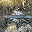
The initiative will expand and modernize New York’s network of streamgages, which will give local governments access to near real-time data on streams and rivers within New York state.
The DEC is contracting with the USGS to upgrade existing streamgages with camera technology, backup data transmission and two-way telemetry. New streamgages will be strategically placed in areas with a high need for flood warnings, while lower-cost virtual streamgages will be used in areas with limited data, according to the Governor’s office.
“This first-in-the-nation initiative will provide communities with data to make life-saving decisions and ensure a safer and more sustainable future for all New Yorkers,” Hochul said.
The network is expected to help communities identify flooding patterns and hydrologic trends, improve flood warnings and make more informed infrastructure decisions.
Hochul also said the network will provide data to help monitor drought conditions, protect clean water supplies and inform water-resource management.
How is FloodSafe NY funded?
FloodSafe NY will be funded through the $4.2 billion Clean Water, Clean Air and Green Jobs Environmental Bond Act and USGS Cooperative Matching Funds.
“As climate change increases the frequency and intensity of flooding, New York State is making historic investments to make our infrastructure more resilient to extreme weather,” Hochul said in a news release.
The initiative builds on the DEC’s Resilient NY stream study program, which utilizes detailed data to prioritize watersheds, inform flood studies and develop flood inundation maps identifying areas at risk of flooding.
Earlier this year, Hochul announced nearly $100 million in new grant funding for nature-based and green infrastructure projects designed to reduce flood risk and improve community resilience to extreme weather.
The funding includes the Resilient Watersheds Grant Program, jointly managed by the DEC and New York State Environmental Facilities Corporation, and the Community Resilience and Flood Risk Reduction Grants Program, administered by the New York State Department of State.
This article originally appeared on Rochester Democrat and Chronicle.
Related: NY energy rebate checks coming soon. Here’s when they hit the mail